Severe Winter Storm Goretti Set to Bring Heavy Snow and Strong Winds to Europe

Storm Goretti is expected to intensify as low pressure deepens after transitioning from warmer to cooler Atlantic waters, steering toward the English Channel, according to Alex Burkill, a meteorologist with the UK Met Office.
“It’s a multihazard event,” Burkill noted. “We’re going to see heavy rain, strong winds, and also some significant and disruptive snow.”
The storm will primarily affect southwestern England, the Channel Islands, and northern France. Red alerts have been issued for Cornwall, the Isles of Scilly, and the French department of Manche, where wind speeds could reach up to 160 kilometers (99 miles) per hour—comparable to a Category 2 hurricane.
In addition, amber warnings have been issued for 20 other French departments, as well as for central England and parts of Wales.
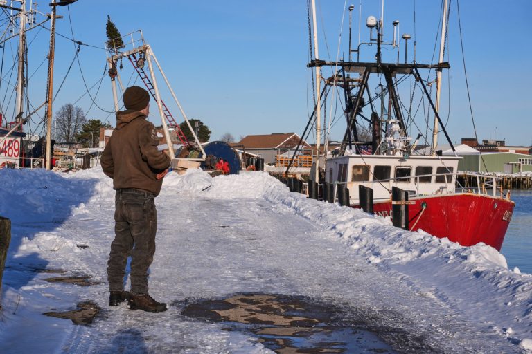
Storm Goretti arrives as the region is still recovering from an Arctic blast that brought plummeting temperatures and increased heating demand, along with heavy snowfall and widespread travel disruptions. Recently, around 1,000 passengers were stranded at Schiphol Airport in Amsterdam due to critical shortages of aircraft de-icing fluid caused by the freezing weather.
Air France-KLM has since replenished its stockpiles of de-icing fluid at Schiphol, but the German aviation group BDL reported that shortages of de-icing equipment and personnel are leading to delays and cancellations across Europe.
As Storm Goretti approaches, it is already causing a new wave of disruptions. German carrier Lufthansa has begun canceling some European flights, and Hamburg Airport has restricted operations to clear snow from its runways.
Germany has issued red alerts in parts of the north, with forecasts predicting as much as 20 centimeters (7.8 inches) of snow in certain areas.
In France, the rail operator SNCF is suspending train services in Normandy from Thursday evening through Friday due to the violent winds. Several train lines in Brittany are also closed.
In the UK, parts of Wales and the Midlands could see accumulations of up to 25 centimeters (9.8 inches) of snow, according to the UK Met Office. Additionally, amber snow and wind warnings have been issued for the Netherlands.
Copyright 2026 Bloomberg.
Storm Goretti is expected to intensify as low pressure deepens after transitioning from warmer to cooler Atlantic waters, steering toward the English Channel, according to Alex Burkill, a meteorologist with the UK Met Office.
“It’s a multihazard event,” Burkill noted. “We’re going to see heavy rain, strong winds, and also some significant and disruptive snow.”
The storm will primarily affect southwestern England, the Channel Islands, and northern France. Red alerts have been issued for Cornwall, the Isles of Scilly, and the French department of Manche, where wind speeds could reach up to 160 kilometers (99 miles) per hour—comparable to a Category 2 hurricane.
In addition, amber warnings have been issued for 20 other French departments, as well as for central England and parts of Wales.
Storm Goretti arrives as the region is still recovering from an Arctic blast that brought plummeting temperatures and increased heating demand, along with heavy snowfall and widespread travel disruptions. Recently, around 1,000 passengers were stranded at Schiphol Airport in Amsterdam due to critical shortages of aircraft de-icing fluid caused by the freezing weather.
Air France-KLM has since replenished its stockpiles of de-icing fluid at Schiphol, but the German aviation group BDL reported that shortages of de-icing equipment and personnel are leading to delays and cancellations across Europe.
As Storm Goretti approaches, it is already causing a new wave of disruptions. German carrier Lufthansa has begun canceling some European flights, and Hamburg Airport has restricted operations to clear snow from its runways.
Germany has issued red alerts in parts of the north, with forecasts predicting as much as 20 centimeters (7.8 inches) of snow in certain areas.
In France, the rail operator SNCF is suspending train services in Normandy from Thursday evening through Friday due to the violent winds. Several train lines in Brittany are also closed.
In the UK, parts of Wales and the Midlands could see accumulations of up to 25 centimeters (9.8 inches) of snow, according to the UK Met Office. Additionally, amber snow and wind warnings have been issued for the Netherlands.
Copyright 2026 Bloomberg.